Benjamin Hardman
All sides of Iceland in one day
This summer, our ambassador, Benjamin Hardman set to traverse and document the whole trail in one straight push, aiming to experience all sides of the landscape and conditions on foot within a 24-hour window
The Laugavegur trail is one of the most popular multi-day hiking routes in the world, spanning 55 kilometers across the highlands of Iceland. With its dynamic and ever-changing scenery, the trail displays a glimpse into all forms of the highland landscape, while exposing hikers to the many faces of the notoriously unpredictable Icelandic weather.
This summer I set a personal challenge to traverse and document the whole trail in one straight push, aiming to experience all sides of the landscape and conditions on foot within a 24-hour window. Having previously only ever ventured by 4x4 in this area, it was an exciting thought to experience the trail for the first time in this way, with many areas still unseen for me as they’re only accessible by means of hiking. Starting out at the hut in Landmannalaugar, I woke at 3:45am to the sound of rain and wind outside, signaling the beginning of a battle I’ll never forget.
With the knowledge that a storm was arriving after noon, I knew that I had to be fast to beat the worst of the weather. As I was hiking alone, I made sure to check in with the camp warden the night before to let them know of my plans, and also packed my GPS device to ensure I could stick to the trail if the visibility disappeared. Being prepared is the key to a safe and successful mission.
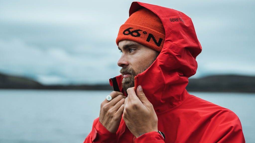
At 4:15am I was on my way, weaving through the jagged lava field of Laugahraun in a light mist of rain before taking a moment to stop and look back over the camp from the view point on Brennisteinsalda. It was here that the visibility began to disappear, much quicker than I’d anticipated, and at this point I quickly came to realize there would be a tough day ahead. I donned my GoreTex outer layers and powered on.
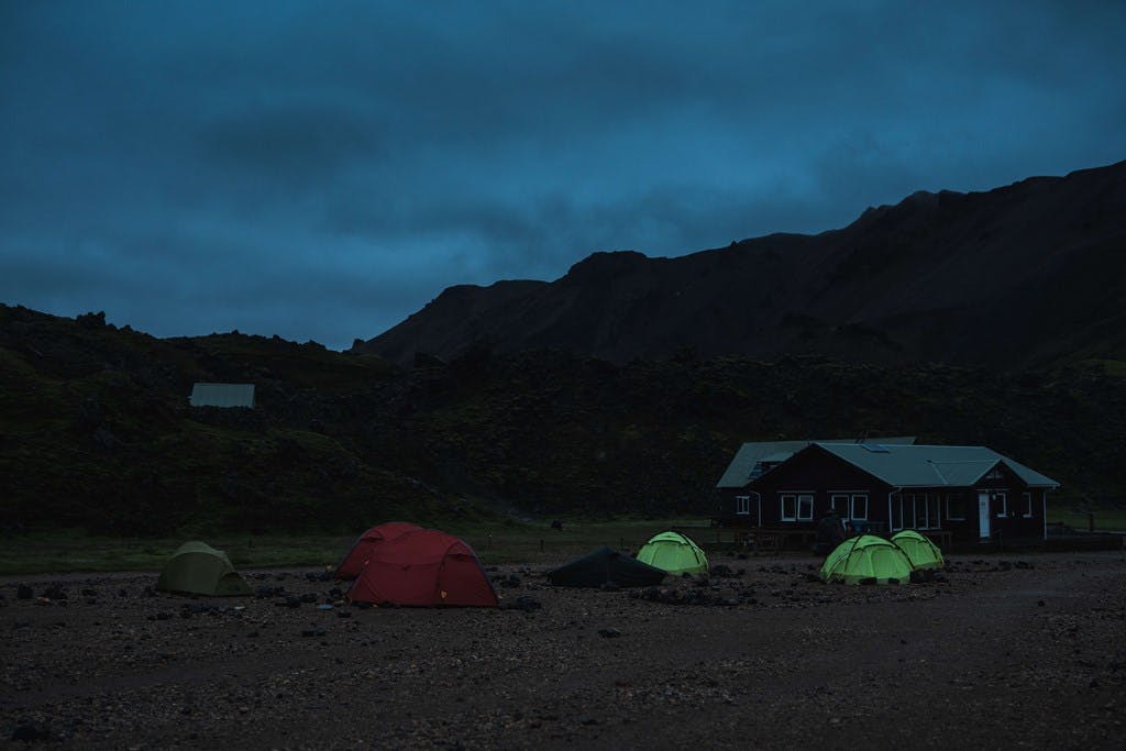
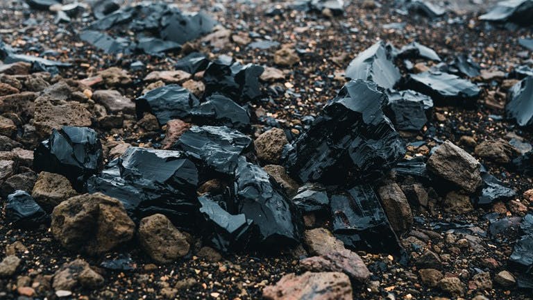
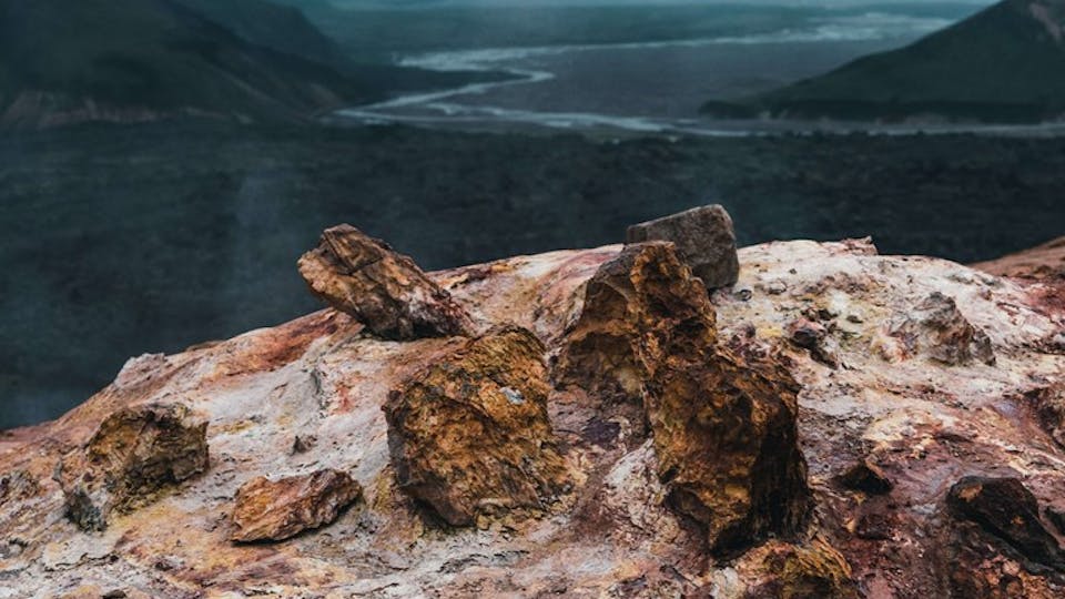
From there, the ascent to Hrafntinnusker began. This area has always been one of my favorites, covered with shards of glistening Obsidian rock and geothermal steam vents. Walking for two hours and 12km through thick fog up to the ridgeline, the signal light of the Hrafntinnusker hut was a welcomed sight. It was a quiet morning up there with most people still asleep in their tents. While chatting to the warden, he told me that the winds were predicted to reach 20 m/s after a few hours, but that I could keep ahead of the wind if I traveled fast.
With the knowledge that a storm was arriving after noon
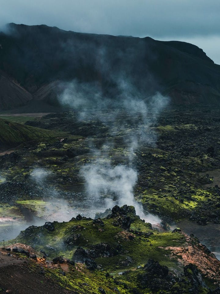

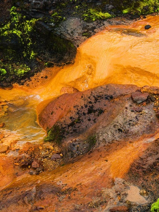
The next few hours were pleasant, passing over a series of snow bridges and through a vibrant geothermal area alongside Kaldaklofsfjöll. Eventually the rain cleared and the sun even popped through the clouds for a minute, it was the classic Icelandic weather scenario. Just as the saying goes however, after five minutes I was back in the rain, greeted shortly after by the wind and back to the normal battles of the day.
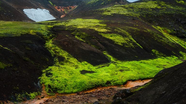
Approaching Jökultungur, I was met with an incredibly beautiful view extending all the way back to Mýrdalsjökull and Eyjafjallajökull. The landscape switches rather suddenly from earthly brown hues to a vast field of vibrant green. The sunlight shone through the falling rain and a rainbow towered over the valley beneath. This was such a special moment for me, I felt a strong connection to the land. Reaching Álftavatn in the late morning and 24km down, I took a moment to dry off and have some much-needed breakfast to refuel for the second half.

With a sign simply directing you a further 16km to Emstrur, it feels like the next stage will be a walk in the park. That was until I began to experience one of the heaviest rain downpours I´ve ever seen in Iceland. For the next few hours, I hiked through sideways rain, battering me from the left side and filling my ear as if I´d been swimming underwater. Knowing this stretch of the hike very well as it´s a common route for my 4x4 missions, I was able to mentally visualize what would be coming next. This really helped me to stay on track and tackle the weather head on.
Before venturing into the vast volcanic ash plains north of Mýrdalsjökull, I came to the first significant river crossing of the hike, Bláfjallakvísl. Often in the summer I ferry hikers over this river in my car, so it was a nice moment to instead take my boots off and wade through the river on foot. It gave me a nice sense of grounding to nature.
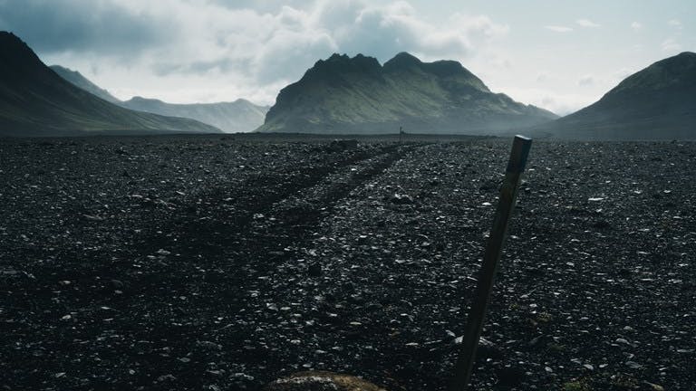

With the rain and wind still by my side, it was time to push forward through the ash plain, a dark, flat and desert like area that has a very unique feeling from the rest of the locations on the hike. It feels like you’re walking on another planet. Upon completing this stretch, I experienced another sudden shift in weather.

Out of nowhere, the rain stopped completely and I began to look up and see patches of blue sky above me, I was amazed at the swift transition. There was of course a catch, the wind started howling relentlessly. I have a vivid memory of the moment I experienced a single gust of wind so strong that it felt as if I´d been hit by a freight train.
With the dry conditions ahead, it was time to layer back down to my lightweight hiking pants and a shell jacket. I also realized that during the few minutes that my boots had been outside in the rain while taking them off and on again at the last river crossing, they’d become really wet inside, so I had to switch out for my backup running shoes. Though finally being dry, while approaching the Emstrur hut and the 40km mark, the wind had added significant mental strain and forced me to really dig deep in order to keep hiking.

At around 5pm I began the final 16km stretch from Emstrur to Þórsmörk. Being the place I´ve spent the most time taking photographs over the years, the excitement of hiking through the whole area on foot gave me some much-needed motivation to push forward. With every hour, the weather improved and the landscape continued to change. I found myself descending through deep canyons, passing by raging glacial rivers and weaving in and out of small grassy valleys. Before I knew it, I could see the peak of one of my favorite mountains, Einhyrningur, peeping down from above the ridgeline. I felt that the end was getting closer.


The final 10km were quite challenging both mentally and physically. Thankfully however, the wind had come to a standstill and I looked out to a beautiful and calm sunset to the West. With 5km remaining, the landscape became incredibly green and trees started to appear, it looked like an oasis.
A friend of mine joined me for the last stretch of hiking, it was nice to have someone to talk to after a day of silent endurance. While making the final crossing over the river Þröngá, I decided that there was no need to stop and take off my boots, so I just went straight into the water. I laughed to myself as it felt like quite a rebelious move after my strategic and well-structured day, but in a state of delirium everything started to seem rational and humorous at that point. Waltzing into Húsadalur just after 10pm, the lights of the Volcano Huts appeared through the trees and the end was in sight. I had envisioned the moment of sitting down for many hours, it was a satisfying moment when it finally happened.
What to wear
Benjamin's favourites
